Hike in Short
| Metric | |
|---|---|
| Distance | 11 km |
| Altimeters | 420m |
| Time | 4h |
| Type | Return trip |
| Part of | - |
| Start Location | Kiental |
| End Location | Kiental |
| Physical difficulty | medium |
| Technical difficulty | easy |
Hiking Map
Hike Report
The Kiental trail is a nice valley snowshoe hike at around 1000 m elevation in the canton of Berner Oberland, relatively close to Spiez.. The hike has a length of 11 km, an elevation gain of 400 m, and mostly well-maintained tracks. The scenery is diverse and the hike not too difficult, so in general it will be a good way to kick-off the snowshoe season. A warning upfront: during the hike you will be mostly walking in the shadows, hence dress up warmly.
The snowshoe trail starts in Kiental, which is a 30 minutes train/bus-trip away from Spiez. First, a train will take you to Reichenbach im Kandertal, from where a connecting bus takes you up the remaining 6 km and 300 height meters to Kiental. On this note, plan your trip well beforehand, as the bus only departs every 1 to 2 hours. From the bus stop, follow the signs to the small local skilift for the start of the trail.

After fastening your snowshoes properly, you will start off easy by following the broad snow-covered path next to the Gornerewasser on your left. Quickly, however, you will turn right from the valley to follow smaller paths through woods and grass fields upwards. While some sections are quite steep, the path is easy to walk on with large sections being broad enough to walk alongside each other. Having mountains constantly towering up on either site, let’s you feel the power of your surrounding and gives a good sense of where you are heading towards.

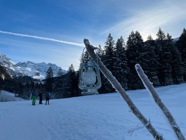
Despite its initial steepness, the first section of the trail passes by quickly due to its diversity: open spaces, idyllic wooden houses, occasionally crossing hedges, forest sections, as well as running and frozen water. Close after the option to already go back to Kiental for a shorter 7-8 km hike (you will take this path on the way back) and a short incline, you will turn right to follow the lantern-path. Depending on the time of year and day, be aware that around this section, the sun will fully be blocked by the surrounding mountains and it might become very cold.


After another section through the woods, you will arrive at the most beautiful part of the trail: a loop around and partly over the frozen Tschingelsee. As the sun probably never reaches this side of the peaks, the landscape is stunning with frozen waterfalls lining up around the valley, a picturesque house and snow-covered trees. Weren’t it for the coldness, you would like to spend hours at this magical wintery place.
The loop ends at the woods again, and after going on the same path as before for a short while, the last 4 km are indicated by a sign to your right. Instead of the open landscape from before, the way back closely follows the Gornerewasser through the woods. Right before reaching Kiental, the path becomes broad and flat again and offers a nice view on the village. Having to wait around 1,5 hours for the next bus to Reichenbach im Kandertal, we decided to walk the remaining 6 km (due to Covid everything was closed and waiting in the cold was not an option).
Video Journal
For more drone and hike videos, you can go Videos.
I like what you’re doing guys. A lot of good tips on new paths to hike. You have a new follower 🙂
Thank you And, this means a lot! Very happy to hear that it provides you with inspiration for going outdoors ?