Yes! We are also on YouTube where we share drone footage of the most astonishing locations we have been to and create video reports of our hiking adventures. Go to Hikes for more information on GPS data, maps and trail descriptions.
-

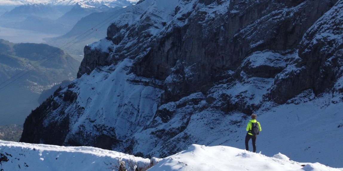
Stormy hiking trip to Brienzer Rothorn
-

Two days panoramic hiking trip through Ticino on Route 52
-

An Easy Hike to Giessbach Falls | Bern, Switzerland
-

Panorama Cross-Country Skiing in Sörenberg Salwideli | Luzern, Swizterland
-

Aletsch Arena Snowshoeing from Fiesch to Bettmeralp | Valais, Switzerland
-

Snowshoeing on the Frozen Lake Tschingelsee | Berner Oberland, Switzerland
-

DRONE360° at Niederhorn | Berner Oberland, Switzerland
-

A Winter Hike with view on Jungfrau, Eiger and Mönch | Bern, Switzerland
-

DRONE360° at Saas Fee | Valais, Switzerland
-

Magical Switzerland Winter Hike from Solothurn to Basel Landschaft
-

Hiking 45km from Meiringen, Grindelwald to Lauterbrunnen | Bern, Switzerland
-

DRONE360° at Grosse Scheidegg | Grindelwald, Switzerland
Video Overview
#1 – The Hardergrat Trail
One of the most exciting hikes in the region of Interlaken is called the “The Hardergrat Trail”. it is very well known for the long-route over the ridge all to the way Brienzer Rothorn. The hike starts in Interlaken (or at the Harder Kulm if you take a cablecar) and brings you to Augstmatthorn at 2137m. Dependent on your speed and time available, you can either continue walking over this ridge. As we did a day hike, we walked back to Habkern via Lombachalp where you can take the bus back to Interlaken. For the full report of the hike including map and GPS files, check out the article.
#2 The Alpentower (Planplatten)
Over the weekends, a perfect day hike is from Hasliberg Reuti to Planplatten (Alpentower) via Käserstatt back to Hasliberg Reuti. Reuti can be reached by cable car, you if you do not feel walking down all the way, you can go back by cablecar. From Käserstatt, you also have the opportunity to go down by “trotti bike” (yes, this is how a mountain proof scooter is called in Switzerland). For the full report of the hike including map and GPS files, check out the article.
#3 – Pilatus Kulm (Obwalden, Switzerland)
In late Autumn, the number of hikes that are still possible with simple hiking gear become less by the day. One of the great summits that can be done throughout many months during the year is the Pilatus Kulm. There are multiple hiking routes that bring you to the top of this mountain.Mount Pilatus is well known from the Golden Triangle, which is a route which can be done both by cable car from Krienz and train to Alpnachstad as well as hiked completely. It is considered to be one of the most beautiful hikes in the area of Lake Lucerne, Switzerland. My favorite way of hiking up the Pilatus Kulm is from Hergriswil via Alpgschwänd to Pilatus Kulm. Do not forget to stop at the Klimsenkapelle, one of the highlights during the hike (4:37 in the video). For the full report of the hike including map and GPS files, check out the article.
#4 – Emmetten – Risetenstock
Hike from Emmetten that brings you way up in the mountains with astonishing views over Lake Lucerne. Summit is called Risetenstock (2290m) which is located at a ridge with both views towards the lake as well as Engelberger Rotstock (2818m). Instead of walking back to Klewenalp, a nice alternative is to walk to Oberrickenbach via Brisen (2404m) or following the ViaUrschweiz (599) route to Gitschenen. For the full report of the hike including map and GPS files, check out the article.
#5 Monte Lema
Ticino offers plenty of opportunity for the outdoor-lovers among us. For amazing views over the Ticino Alps while walking over a ridge is the hike to Monte Lema. The hike starts in Miglieglia and brings you to Monte Lema at 1619m (but there are several other paths to get there). From there, you can follow the route in the direction of Monte Magno (1589m) and Monte Tamaro (1961m). We personally chose to go back to Miglieglia at Zottone (1569m) as we only started the hike late in the morning. However, if you start early morning, good alternatives are to walk all the way to Monte Tamaro (±15km on top of) or walk to Fescoggia or Brena, where you can take the bus back to the Miglieglia. The hike is part of Route 52 called Sentiero Lago di Lugano. For the full report of the hike including map and GPS files, check out the article.
#6 The Wildspitz
Just above Lake Lucerne (Vierwaldstättersee) at the east side of Lake Zug (Zugersee) there is a peak called the Wildspitz. Starting in Arth-Goldau, the trail will bring you up to the Wildspitz peak at 1580m, providing astonishing views over the mountains in Luzern area, Zugersee and Lauerzersee. We started off the hike quite disappointed due to the large amount of fog in the valley. Nevertheless, we kicked off and we were literally escaping clouds while climbing through the forest. From the peak, we walked back to Sattel and took the train back to Arth-Goldau (±15 minutes). The hike is part of Route 63 called the Schwyzer Höhenweg. For the full report of the hike including map and GPS files, check out the full hiking report of the Wildspitz.
#7 Greina Trail
One of the lesser known hikes in Ticino, further away from the popular hiking regions is the Greina Plateau. You will need a car to get to the village Campo (Blenio) which is the starting location of this hike, but it is definitely worth the ride! The Greina Plateau is part of Switzerland’s Federal Inventory of Landscapes and Natural Monuments of National Importance. You can either turn around and go back via the route as shown in the Greina hiking report or keep following the Alpenpässe Weg (Route 6) via Crap La Crush to go back Capanna Motterascio and then via Lago di Luzzone back to Campo (start of the trail). In case you choose this option, be prepared to walk around 27 kilometers.
#8 Meiringen Lauterbrunnen (Via Alpina)
The tour from Meiringen (via the Sherlock Holmes Trail) through Grindelwald to Lauterbrunnen is perfect for a two-day hike in the canton of Bern. Following the signs of Via Alpina 1 , you will pass by the regions most iconic places and mountains: Reichenbachfall, Eiger, Jungfrau, Wengen, Grosse Scheidegg and Kleine Scheidegg. Overall the trail is easy to walk with several sections on paved road and the rest on gravel, forst paths and occasional grass fields. For more information on the trail, click on the link below for free map, route details and GPS data.